


downloads


Hikers find in Rio a great destination for their journeys. The adventurers have the opportunity to find outstanding landscapes with a breathtaking view on arrival at the top. Furthermore, our city features several parks of all kinds of audiences and in all areas. Regardless of the path, Rio is a great place to be explored. To venture out on the trails, the help and accompaniment of a local guide is highly recommended. Check out the list of one of these places.
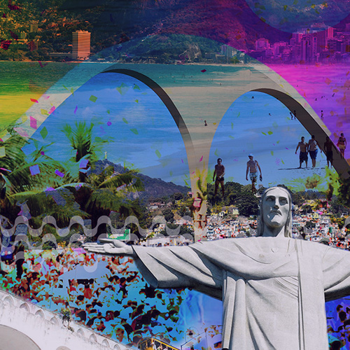
Click to download in PDF: Routes Cariocas – RIO PARKS AND TRAILS
CIRCUITO DAS GRUTAS
Located inside the Tijuca Forest, the circuit goes through eight caves in three hours well spent. The walk is considered light and just gets a little difficult at the time of entering the caves, where attention must be redoubled since the rock formations originated from landslides through tectonic movements and have existed for thousand years. The use of an experienced guide is recommended.
Address: Estrada da Cascatinha, 850 – Alto da Boa Vista
MORRO DOIS IRMÃOS
Dois Irmãos Hill is an impressive figure and is recurrently seen in the background of pictures taken of Ipanema and Leblon beaches. The top of Dois Irmãos Hill is higher than the Sugar Loaf mountain itself. The walk is lighter than you might expect.
Address: Av. Niemeyer, Campo de Futebol na Vila Olímpica do Vidigal – São Conrado/Leblon
PARQUE NATURAL MUNICIPAL DA CATACUMBA
The Municipal Natural Park of Catacumba is located in an area that has been reforested in the seventies.With almost 27 hectares, The path presents a great diversity of trees, plants and flowers. On the low side,several sculptures can be admired in the open. Paved roads and little squares with stone floors make the perfect place for walks and picnics.
Address: Av. Epitácio Pessoa, 3000 – Lagoa
PISTA CLÁUDIO COUTINHO
The paved path starts at the end of Red Beach and has an extension of 1,25km. Along the way, the visitor walks surrounded by the sea on one side and by the green of Urca Mountain on the other, and has the opportunity to watch native trees as Pau- Brasil and fig trees. Wild animals are also frequently seen, such as marmosets and Tiê-sangue birds – the symbolic tree of Mata Atlântica.
Address: Urca, Rio de Janeiro – RJ, 22290-270
TRILHA DA PEDRA BONITA
This trail is located inside the National Park of Tijuca, precisely between Gávea Rock and the districts of São Conrado and Barra da Tijuca. On reaching the summit, you come across with a stunning view of Gávea Rock, Barra beaches, São Conrado, Leblon and Ipanema, besides Dois Irmãos Hill, Tijuca Forest and certain parts of the South Zone. The trail lasts about 40 minutes.
Address: Estrada da Pedra Bonita – São Conrado
TRILHA DO MORRO DA URCA
It´s 40 minutes alternating between steep climbs and flat stretches that lead to a breathtaking panorama of Guanabara Bay – The Cove of Botafogo until Flamengo Embankment – through the beaches of the South Zone until the Center, Santos Dumont Airport, Governador Island and even part of Niteroi. The trail is considered light and relatively easy to do.
Address: Praça General Tibúrcio, Praia Vermelha
AGULHINHA DA GÁVEA
Known as Pedra Aguda, Agullhinha stands out among the mountains of the park due to its pointed shape, besides having an incredible view of São Conrado Beach and surroundings. With about ten climbing routes, Agulhinha is faster to climb in comparison with Gávea Rock, because the access is easy and the wall is smaller.
Address: Estrada das Canoas, s/nº, São Conrado
AGULHINHA DO INHANGÁ
Known as Dog Rock, it stands out by the rock formation of Copacabana. With its 164 meters, the trail is anchored by the rocks. In the seventies, the rock was anchored by concrete blocks in order to avoid rock rolling for it is surrounded by buildings.
Address: Ladeira dos Tabajaras, nº 300
TRILHA DO MORRO DA BABILÔNIA
The visitor takes around two hours to complete the stretch over 1,2 Km. The internal signage is complete and of easy guidance. This trail brings a good opportunity to know the lifestyle of an under resourced community, but rich in natural beauty – Chapéu Mangueira is Morro of Babilônia itself.
Address: Ladeira Ary Barroso, 44 – Leme
QUINTA DA BOA VISTA
A true pearl of the city, Quinta da Boa Vista is one of the biggest urban parks in carioca soil, about 155 thousand square meters.Located in the district of São Cristovão, it preserves the gardens created by French landscaper Auguste Glaziou. The park also houses the National Museum, considered Brazil´s oldest scientific institution, that goes through a process of reconstruction.
Address: Avenida Pedro II, s/n – São Cristóvão
BICO DO PAPAGAIO
Bico do Papagaio has a summit of 989 meters high and is one of the most frequented of the Tijuca National Park, such as Barra and Recreio beaches, with the entire Baixada de Jacarepaguá in the background.
Address: Praça Afonso Viseu – Alto da Boa Vista
VISTA CHINESA
This monument built at the beginning of XX Century as a tribute to the Chinese and importing tea cultivation in Brazil offers a broad overview full of green of the Carioca South Zone. The trail is easily accessible and is totally paved, leading to the viewpoint in a demanding ascent, steep, but makes up for it with one of the most beautiful peaks in town.
Address: Estrada Dona Castorina, s/n – Alto da Boa Vista
MIRANTE DO EXCELSIOR
The trail is considered ideal for those not very experienced. The path is of light level with a one hour walk and is located at the end of Road of Excelsior, from where you can see an incredible view of the city. Its name is a tribute to Longfellows homonymous novel.
Address: Estrada do Excelsior – Alto da Boa Vista
PICO DA TIJUCA MIRIM
In front of Pico da Tijuca, in a lower level, the monument is 917 meters high. The path is made up of a stone block covered with small bushes and low vegetation.The trail is the same that goes until Pico da Tijuca and it is relatively easy, well marked and protected by the shade of trees.
Address: Praça Afonso Viseu, Alto da Boa Vista
PICO DO PERDIDO
Also known as Pico do Perdido or even Pico do Perdido of Grajaú, it is the main symbol of the neighborhood. Located inside Tijuca Forest, but located in the district of Grajaú, is one of the divisions with State Park of Grajaú.
Address: Praça Malvino Reis, 38 – Grajaú
TRILHA DA CACHOEIRA DO JEQUITIBÁ
One of many belonging to Tijuca National Park is considered the shortest trail to a waterfall and provides not only sunshine, freshwater, smell of bush, but also an incomparable look.
Address: Estrada da Vista Chinesa, 2120 – Alto da Boa Vista
TRILHA PEDRA DA GÁVEA
Its 844 meters of height have given it the irrefutable title of the most difficult trail of the city, with a minimum route of 3 hours(ascent). The path requires a lot of attention, physical fitness and preferably the support of an experienced guide in the long and heavy project. But the view is unique!An experience for those who like adventure is essential.
Address: Estrada Sorimã – Barra da Tijuca
PARQUE NATURAL MUNICIPAL CHICO MENDES
Located in a sandbank area, the sandy plain of Baixada of Jacarepaguá, the Park was created with the aim of preserving Lagoinha das Tachas and its surroundings, place of occurrence of species of fauna and flora considered rare and endangered. The maintenance of the natural conditions of the Park allows the survival of the Jacaré-de-papo-amarelo, one of the main residents of the place.
Address: Av. Jarbas de Carvalho, 679 – Recreio dos Bandeirantes
COSTÃO DO PÃO DE AÇÚCAR
This path was opened in 1817 when the Sugar Loaf mountain was conquered.The trail starts at Track Claudio Coutinho and in 20 minutes we reach the beautiful viewpoint with a view to the entrance of Guanabara Bay and the city of Niterói. The most vertical section of the sidewalk is approximately 20 meters high and is considered a basic level climbing.
Address: Av. Estado da Guanabara, 1185 – Recreio dos Bandeirantes
MIRANTE DO CAETÉ
The trail of Mirante of Caeté is considered one of the most quiet to walk in the West Zone. It is located in Prainha, one of the most beautiful of the region. This path being so easy, the visitor takes about 25 minutes to get to the top.
Address: Av. Estado da Guanabara, 1185 – Recreio dos Bandeirantes
TRILHA PEDRA DO TELÉGRAFO
Famous for its optical illusion photos, the Rock is located in Barra of Guaratiba, inside the State Park of Pedra Branca,in the sector of Wild Beaches. To get to the site is necessary to pass through one of the two trails, about 3 km round trip which starts at Point do Telégrafo restaurant.
Address: Estrada do Pau da Fome, 4003 – Taquara
MIRANTE DONA MARTA
From the top of its 360 meters, Viewpoint Dona Marta provides one of the most incredible views of the city securing the title of one of the most visited attractions of Rio. From there it is possible to see the Sugar Loaf Mountain, the Christ Redeemer, Maracanã Stadium, Guanabara Bay and Rodrigo de Freitas Lagoon.
Address: Estrada Mirante Dona Marta – Santa Teresa
Sending message...